YOUR NEXT DISCOVERY/SpaceFollow your curiosity
Mimas Global Map - June 2017
NASA / JPL · Reuse terms

Space / 2017-06-13

Mimas Global Map - June 2017

Mimas Global Map - June 2017

NASA's image library records Mimas Global Map - June 2017.

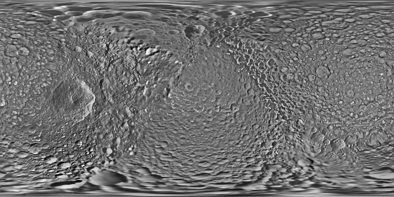
This global map of Saturn's moon Mimas was created using images taken during Cassini spacecraft flybys. The moon's large, distinguishing crater, Herschel, is seen on the map at left. The map is an equidistant (simple cylindrical) projection and has a scale of 710 feet (216 meters) per pixel at the equator. The mean radius of Mimas used for projecti

SERENDIPITYA little unexpected
FamiliarWeird

This global map of Saturn's moon Mimas was created using images taken during Cassini spacecraft flybys. The moon's large, distinguishing crater, Herschel, is seen on the map at left. The map is an equidistant (simple cylindrical) projection and has a scale of 710 feet (216 meters) per pixel at the equator. The mean radius of Mimas used for projection of this map is 123.2 miles (198.2 kilometers). The resolution of the map is 16 pixels per degree. The update includes new images for almost half of the moon's surface, with new images from two close flybys, in Nov. 2016 and Feb. 2017. The moon's western hemisphere, south pole and parts of the eastern hemisphere received updates in this version. https://photojournal.jpl.nasa.gov/catalog/PIA17214

Explore NASA's original image record for credits and available downloads.

NASA Image and Video LibraryMimas Global Map - June 2017

Original explanation based on the sources above. Images carry their own reuse terms.