YOUR NEXT DISCOVERY/SpaceFollow your curiosity
Topography of Earth's moon
NASA / GSFC · Reuse terms

Space / 2017-12-08

Topography of Earth's moon

Topography of Earth's moon

NASA's image library records Topography of Earth's moon.

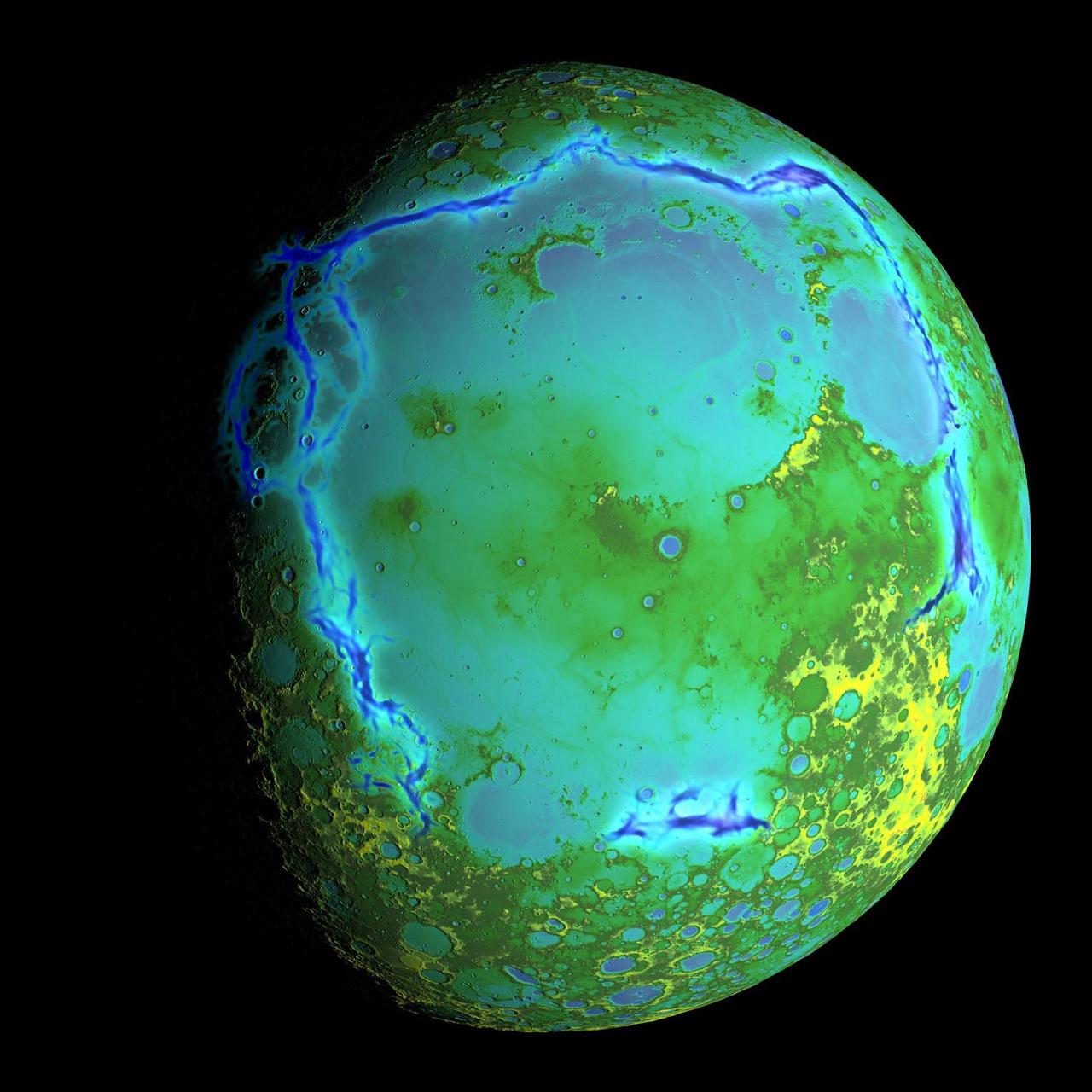
Topography of Earth's moon generated from data collected by the Lunar Orbiter Laser Altimeter, aboard NASA's Lunar Reconnaissance Orbiter, with the gravity anomalies bordering the Procellarum region superimposed in blue. The border structures are shown using gravity gradients calculated with data from NASA's Gravity Recovery and Interior Laboratory

SERENDIPITYA little unexpected
FamiliarWeird

Topography of Earth's moon generated from data collected by the Lunar Orbiter Laser Altimeter, aboard NASA's Lunar Reconnaissance Orbiter, with the gravity anomalies bordering the Procellarum region superimposed in blue. The border structures are shown using gravity gradients calculated with data from NASA's Gravity Recovery and Interior Laboratory (GRAIL) mission. These gravity anomalies are interpreted as ancient lava-flooded rift zones buried beneath the volcanic plains (or maria) on the nearside of the Moon. Launched as GRAIL A and GRAIL B in September 2011, the probes, renamed Ebb and Flow, operated in a nearly circular orbit near the poles of the moon at an altitude of about 34 miles (55 kilometers) until their mission ended in December 2012. The distance between the twin probes chan

Explore NASA's original image record for credits and available downloads.

NASA Image and Video LibraryTopography of Earth's moon

Original explanation based on the sources above. Images carry their own reuse terms.